The mine, year by year
Telkwa Coal's 2022 Application includes its own drawings of the site at each stage, from first clearing to fifty years on. They are collected here so you can step through them.
What you are looking at
- These are the proponent's drawings. All 63 come from the Application filed in May 2022: 51 from Section 1.9 of the Application Overview, and 12 (eleven maps and their legend) from Appendix 13.9-J, whose pages are dated August 2021. The captions under each one are ours and describe only what the drawing shows.
- Years count from the start of mining. Year −0.5 is early construction, Year 0 is the end of construction, Year 21 is the end of mining, Year 25 the end of reclamation.
- The "management ponds" hold the acid-generating rock. The cross-sections label their contents "Saturated PAG": potentially acid generating rock kept under water behind earth dams.
- The design may have moved on. These drawings date from 2022. Telkwa Mining's 2026 answers on water are covered on a separate page.
The site, from clearing to Year 50
Twelve drawings on the same base map. Brown is cleared ground, yellow and orange are dams, blue is water, tan is open pit, pink is backfill, green is ground drawn as soil-replaced and revegetated.
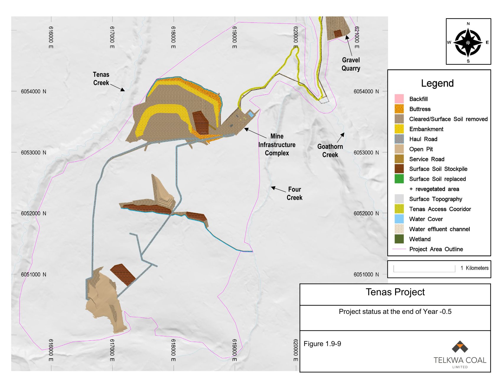
Project status at the end of Year -0.5 Ground is cleared and soil stripped where the two northern ponds will sit, and their embankments are going up. Haul roads are cut. Excavation has started at two places in the pit area. Soil stockpiles, the gravel quarry and the access corridor are in place. Source: Figure 1.9-9, 2022 Application Overview. Select the drawing to open it full size.
The whole project, including the haul route and rail loop
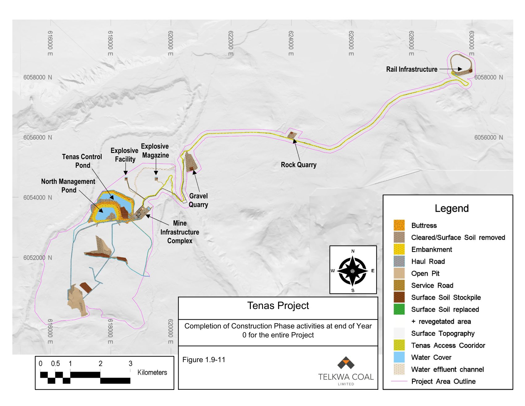
Completion of Construction Phase activities at end of Year 0 for the entire Project The wider view: the Tenas Access Corridor runs north-east from the mine to the rail loop, passing a rock quarry. Source: Figure 1.9-11, 2022 Application Overview. Select the drawing to open it full size.
The same stages, seen at an angle
Eleven maps and a legend from Appendix 13.9-J of the Application, "Maps of Tenas Project Site". The appendix is attached to the Mine Emergency Response Plan, and its pages are headed "Mine Plan Maps". Each map is drawn over an air photo and viewed at an angle. The appendix captions ten of them as road plans and leaves the Year 25 map without a caption. Where the heading printed on a map differs from its caption, our text quotes the heading.
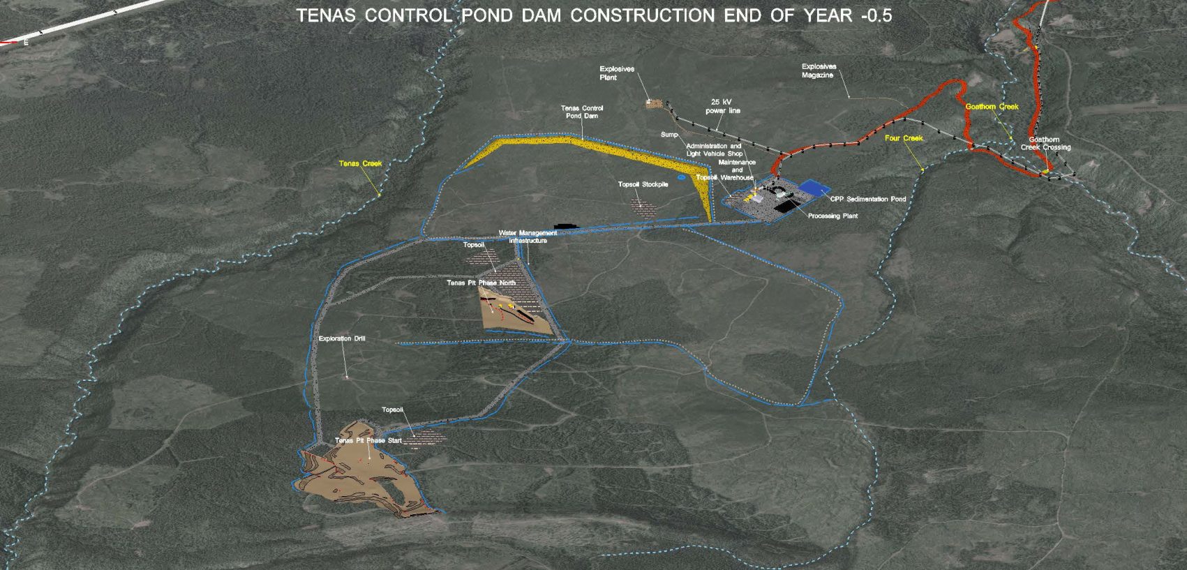
Road Plan at the end of Year -0.5 The heading printed on the map reads "Tenas Control Pond Dam construction end of Year -0.5". The Tenas Control Pond Dam is drawn as compacted dam material, with no water behind it. Open pit is drawn at two places, labelled Tenas Pit Phase North and Tenas Pit Phase Start. Haul roads, topsoil stockpiles, the Processing Plant, the coal processing plant (CPP) Sedimentation Pond, a 25 kilovolt (kV) power line and the Tenas Access Corridor are shown. Source: Figure 1, Appendix 13.9-J, 2022 Application. Select the drawing to open it full size.
The dams in cross-section
Two plans and five sections through the dams as they would stand at the end of mining. Each drawing is stretched vertically by 2.5 times, so the slopes look steeper than they would be built.
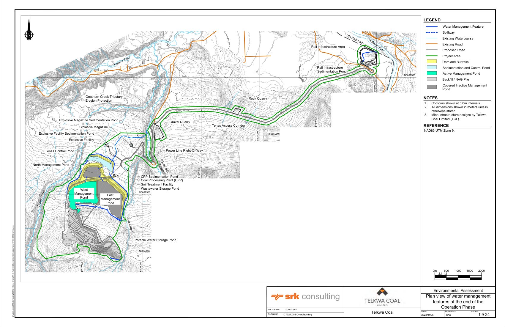
Plan view of water management features at the end of the Operation Phase The engineer's plan of every pond, channel and dam, including the rail-loop pond. Source: Figure 1.9-24, 2022 Application Overview. Select the drawing to open it full size.
| Dam | Crest | Water level | Buttress top | Lowest toe | Crest above toe | Figure |
|---|---|---|---|---|---|---|
| Tenas Control Pond | 800 | 798 | 792 | 782 | 18 m | 1.9-26 |
| North Management Pond | 830 | 828 | 812 | 802 | 28 m | 1.9-27 |
| East Management Pond | 852 | 850 | 820 | 804 | 48 m | 1.9-28 |
| West Management Pond | 852 | 850 | 830 | 806 | 46 m | 1.9-29 |
| East and West separation | 852 | 850 | none | 832 | 20 m | 1.9-30 |
Elevations are metres above sea level, read from the labels on each drawing. "Crest above toe" is our subtraction. The drawings give embankment slopes of 2.5 horizontal to 1 vertical on the pond side and 3 to 1 on the outer side, with buttress slopes of 5.5 or 6 to 1.
Each pond, as it is built
The dams are raised in stages while rock is placed behind them. These sections follow each one from its starter embankment to Year 5.
Tenas Control Pond
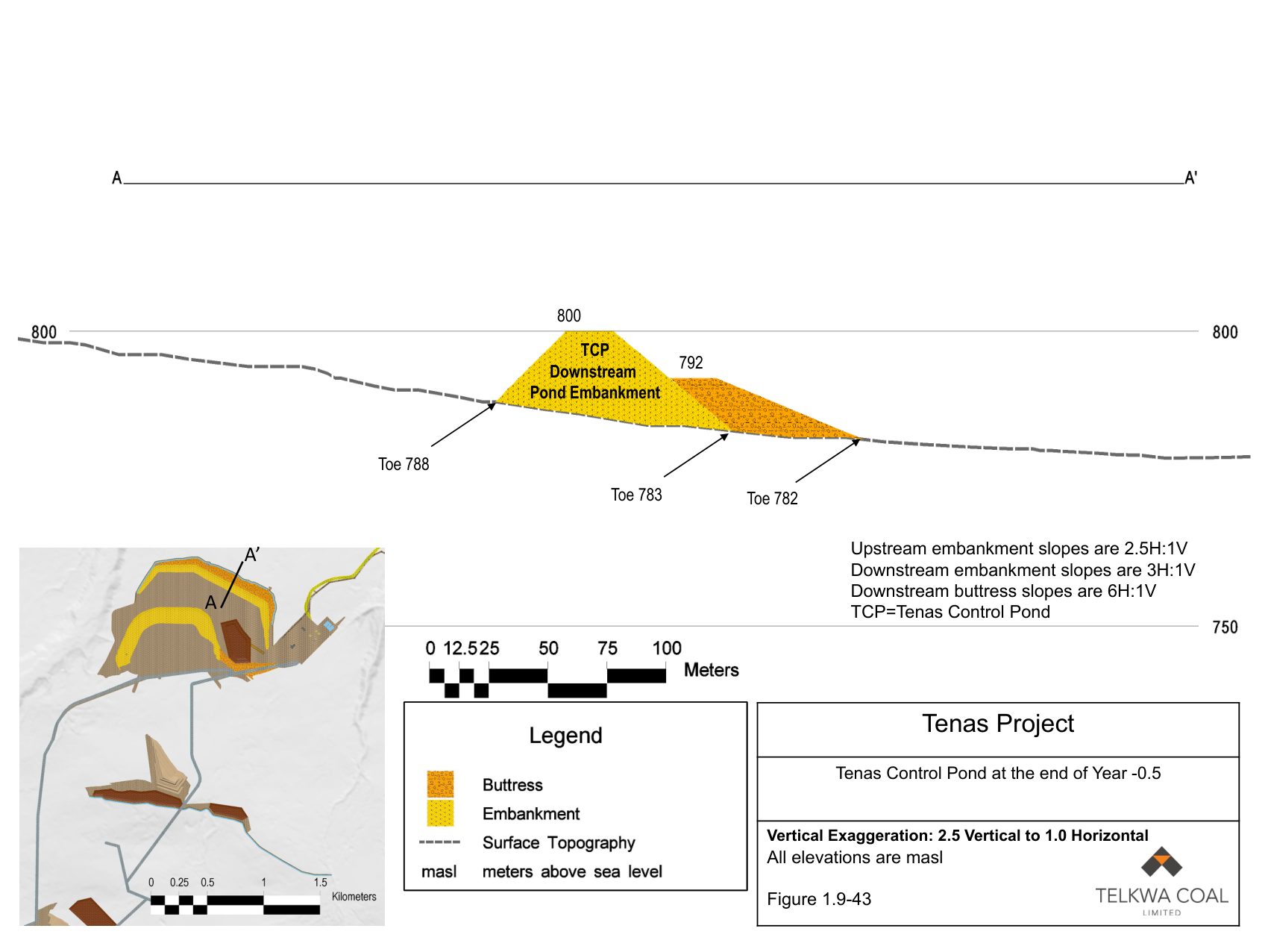
Tenas Control Pond at the end of Year -0.5 Embankment and buttress built to the 800 m crest. No water yet. Source: Figure 1.9-43, 2022 Application Overview. Select the drawing to open it full size.
North Management Pond
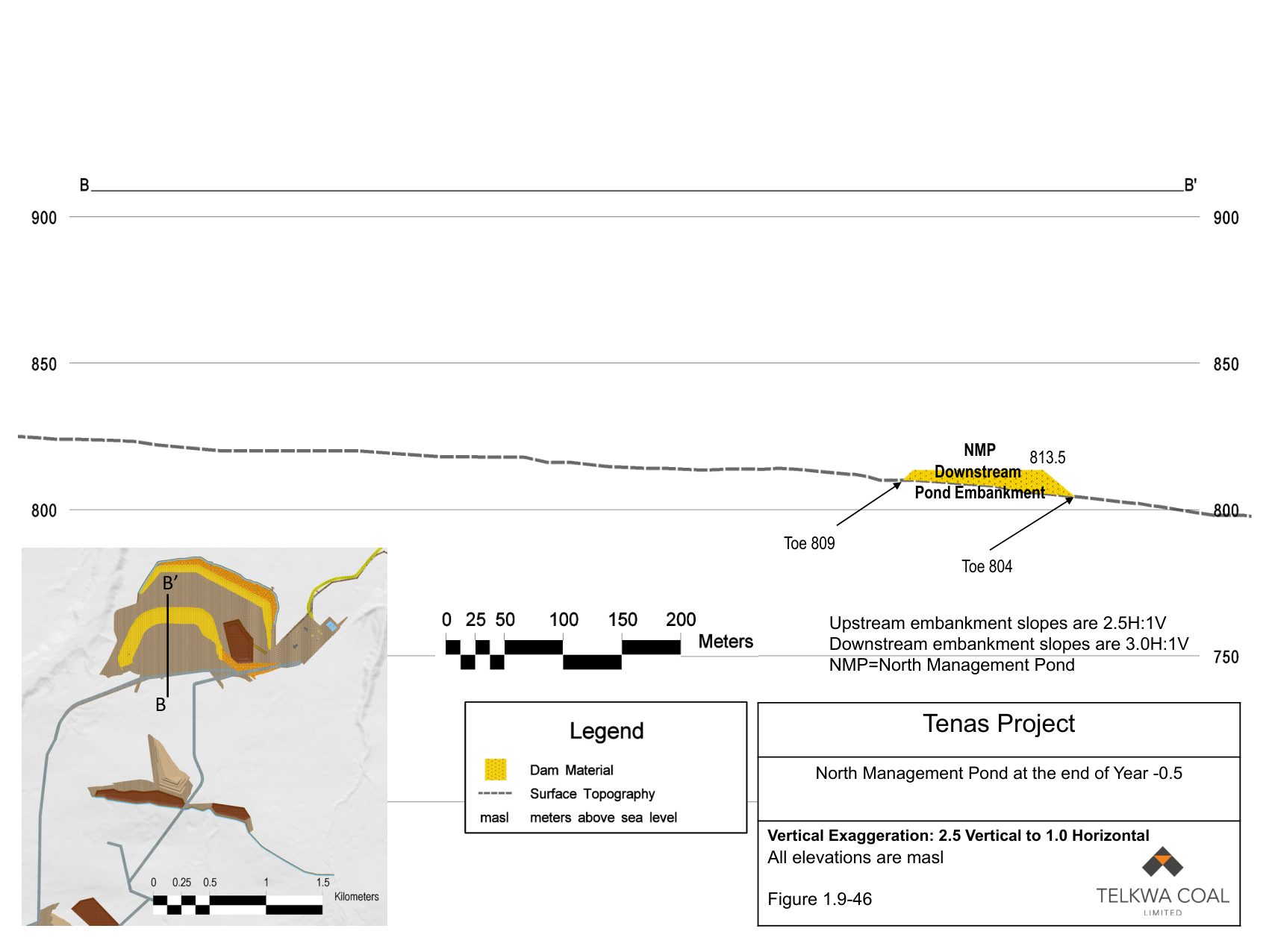
North Management Pond at the end of Year -0.5 A starter embankment to 813.5 m. Source: Figure 1.9-46, 2022 Application Overview. Select the drawing to open it full size.
East Management Pond
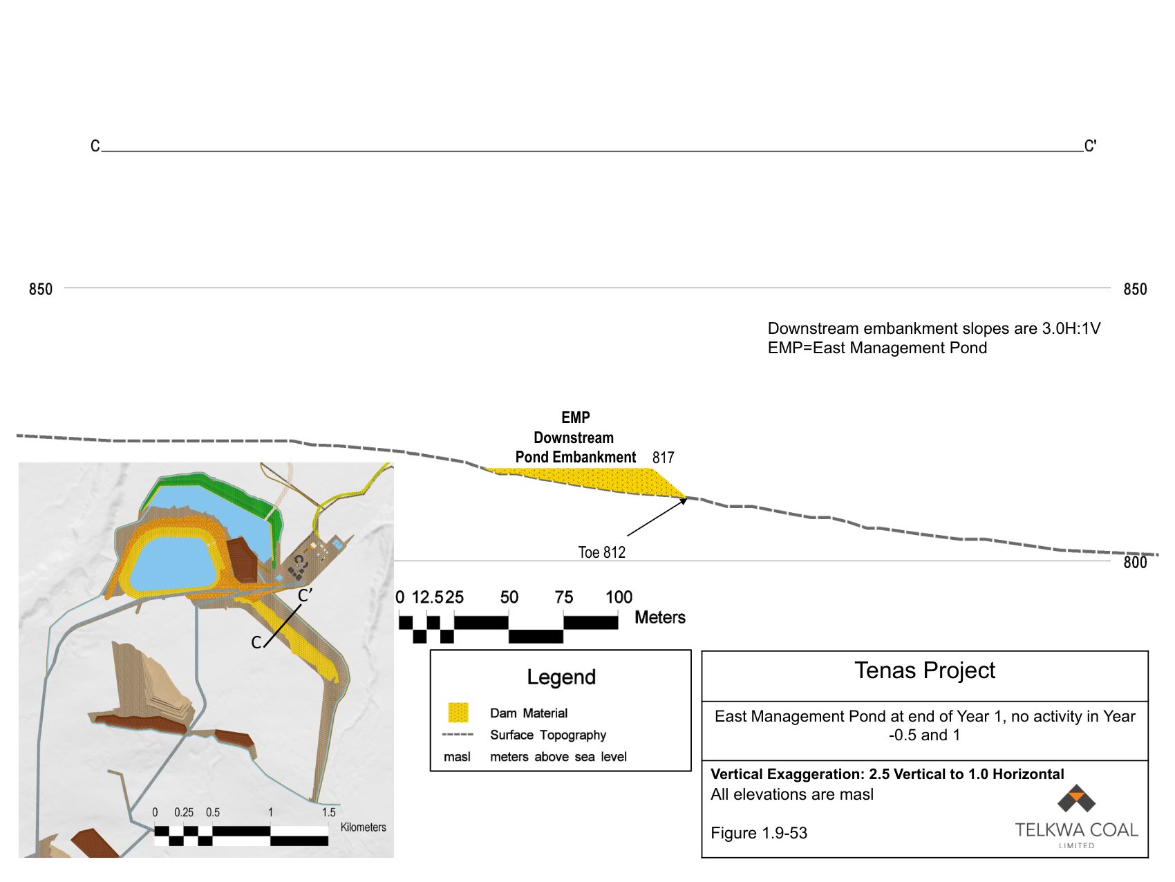
East Management Pond at end of Year 1, no activity in Year -0.5 and 1 A starter embankment to 817 m. Source: Figure 1.9-53, 2022 Application Overview. Select the drawing to open it full size.
West Management Pond
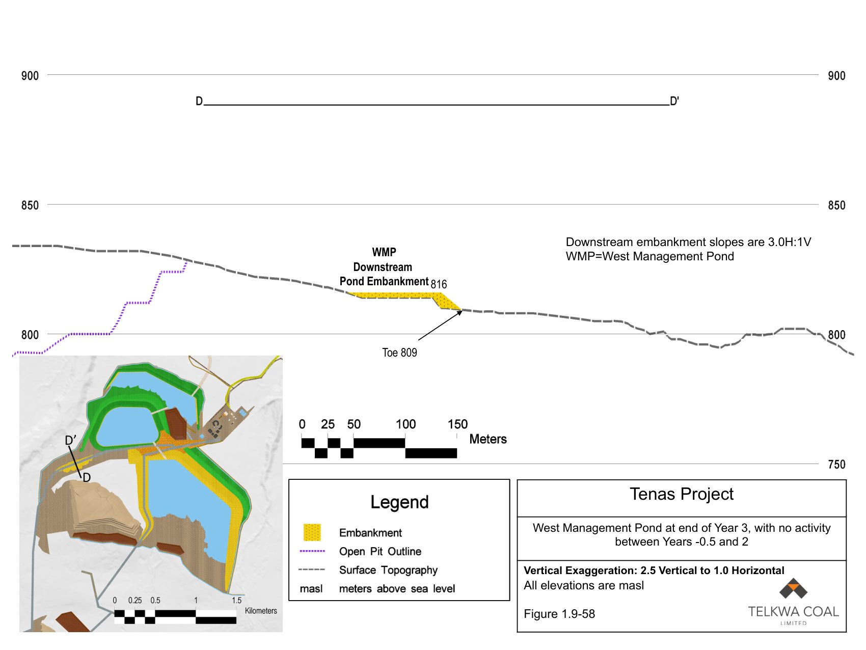
West Management Pond at end of Year 3, with no activity between Years -0.5 and 2 A starter embankment to 816 m, beside the open pit. Source: Figure 1.9-58, 2022 Application Overview. Select the drawing to open it full size.
East and West separation embankment
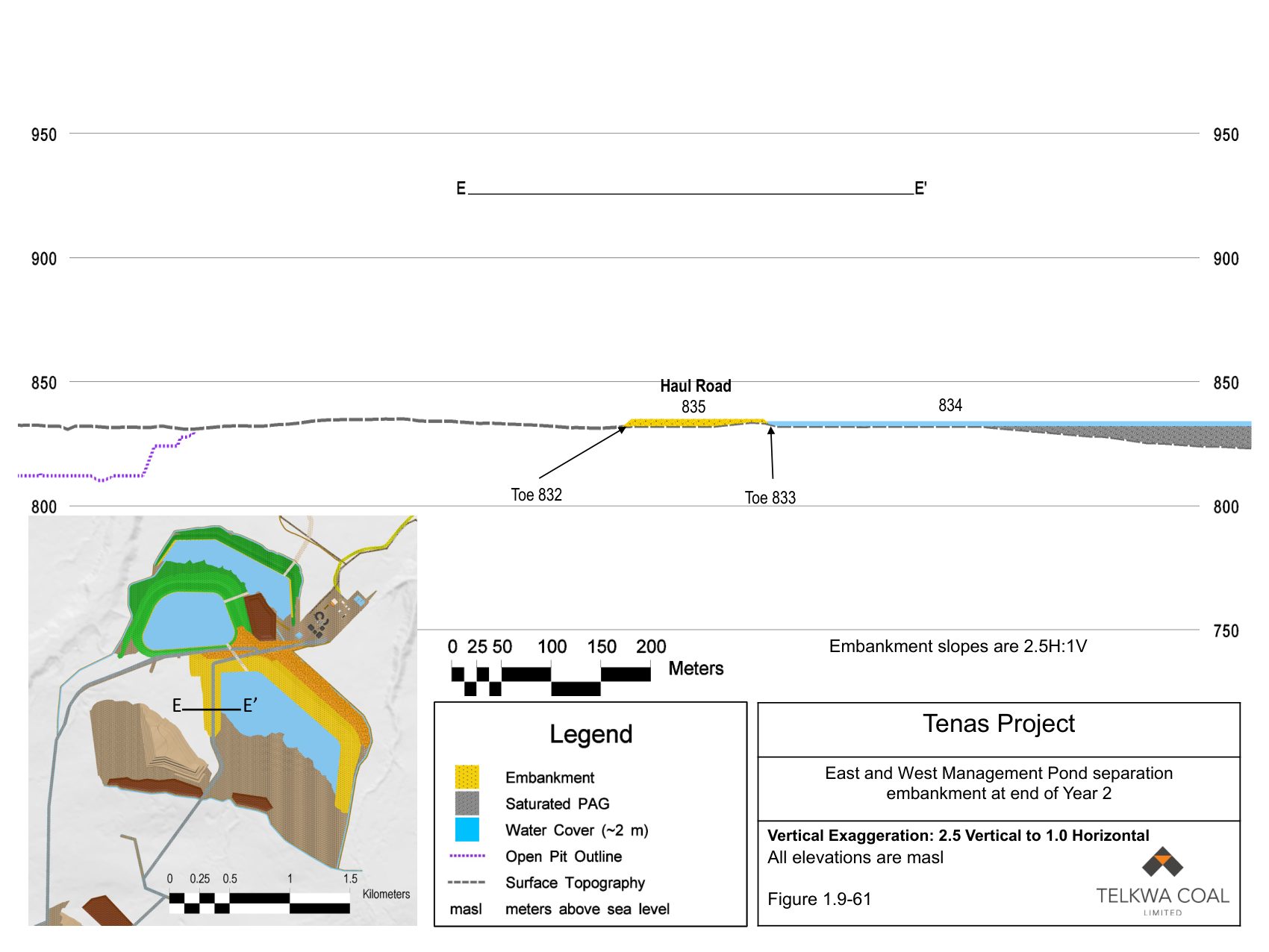
East and West Management Pond separation embankment at end of Year 2 Crest at 835 m; East pond water at 834 m. Source: Figure 1.9-61, 2022 Application Overview. Select the drawing to open it full size.
The pit backfill
Sections through the pit at the end of mining, showing where rock is put back and where the coal seams continue beyond the pit.
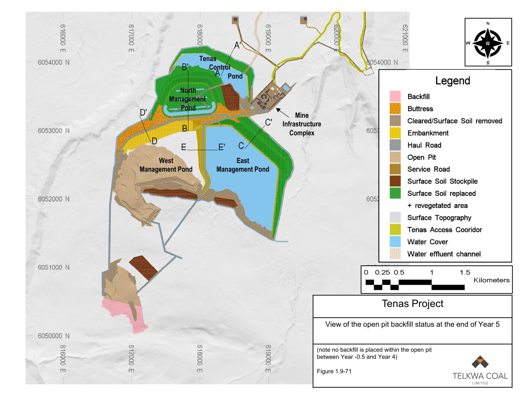
View of the open pit backfill status at the end of Year 5 The drawing notes that no backfill is placed in the pit before Year 5. Source: Figure 1.9-71, 2022 Application Overview. Select the drawing to open it full size.
Source
Tenas Project Application for an Environmental Assessment Certificate, Section 1.0 Overview, May 2022, Figures 1.9-9 to 1.9-64 and 1.9-71. The Overview is split across several files in the registry; these figures are in Part B, Part C, Part D and Part E. Each drawing above links to its own page in those files.
The eleven angled maps and their legend are from the same Application, Section 13.0 Management Plans, Chapter 9 Mine Emergency Response Plan, Appendix 13.9-J, Maps of Tenas Project Site, Figures 1 to 10 and one unnumbered map. Its pages carry the document number EMS-App 13.9-I and the date August 2021.